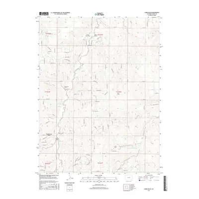
2016 Map of Cabin Gulch
USGS Topo · Published 2016About this map
Running Creek meanders through this portion of Elbert County, carving a landscape defined by prominent drainage channels and gulches. The drainage network is dense, featuring named terrain such as Whiskey Gulch, Cabin Gulch, and Timber Claim Gulch, which reflect the early resource-based history of the area. Modern residential expansion is visible at Ponderosa Park, where a dense network of suburban roads like Vista Ridge Rd and Deer Creek Dr contrasts with the large rural parcels and section lines that dominate the surrounding territory.
Find a feature on this map
96 named features on this map. Tap any name to fly to it.
Don’t see what you’re looking for? This feature index may not catch every label — zoom into the map to look around manually.
Map Details
Editions of this 2016 Cabin Gulch Map
This is the sole edition of this map. No revisions or reprints were ever made.
Other maps of this area

1890 · East Denver
USGS Topo · 1:125,000

1894 · Castle Rock
USGS Topo · 1:125,000

1913 · Castle Rock
USGS Topo · 1:125,000

1939 · Elizabeth
USGS Topo · 1:62,500

1940 · Piney Creek
USGS Topo · 1:24,000

1942 · Piney Creek
USGS Topo · 1:31,680

1945 · Elizabeth
USGS Topo · 1:62,500

1953 · Denver
USGS Topo · 1:250,000

1955 · Watkins SE
USGS Topo · 1:24,000

1957 · Denver
USGS Topo · 1:250,000