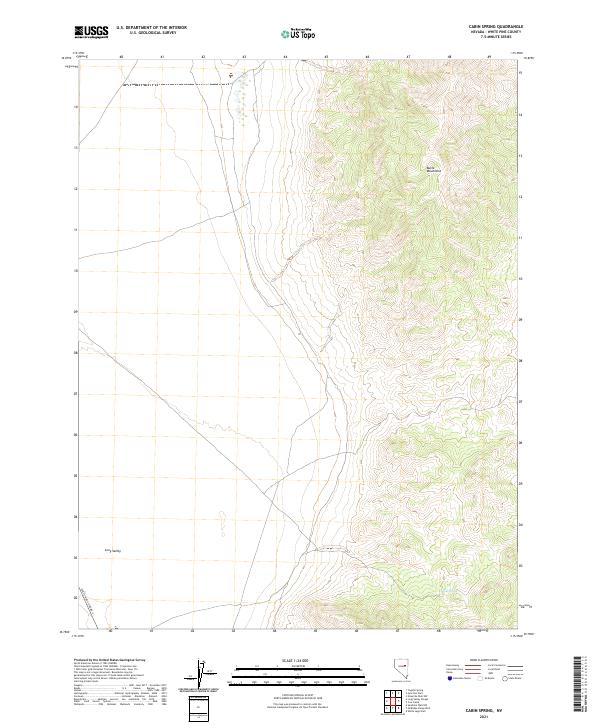
2021 Map of Cabin Spring
USGS Topo · Published 2021About this map
Butte Mountains dominate the eastern half of this terrain, where steep elevation changes define the local geography. At the base of these heights, Cabin Spring provides a critical water source in an otherwise arid basin. The western portion of the sheet opens into the wide expanse of Long Valley, a characteristic Great Basin landform where the valley floor sits at nearly 6,000 feet. This landscape is sparsely developed, with White Pine Co Road 3 serving as the primary corridor through the valley, connecting the remote rangeland to the larger county network. The map reveals the intricate drainage patterns flowing from the high peaks toward the valley floor, illustrating the importance of isolated water points like the spring for land use in this part of eastern Nevada.
Find a feature on this map
8 named features on this map. Tap any name to fly to it.
Don’t see what you’re looking for? This feature index may not catch every label — zoom into the map to look around manually.
Map Details
Editions of this 2021 Cabin Spring Map
This is the sole edition of this map. No revisions or reprints were ever made.
Other maps of this area

1956 · Ely
USGS Topo · 1:250,000

1959 · Ely
USGS Topo · 1:250,000

1963 · Ely
USGS Topo · 1:250,000
1982 · Junction Well
USGS Topo · 1:24,000
1982 · Cabin Spring
USGS Topo · 1:24,000

1982 · White Sage Well
USGS Topo · 1:24,000
1982 · McBrides Sheep Well
USGS Topo · 1:24,000
1982 · Long Valley Slough
USGS Topo · 1:24,000
1982 · Cow Camp
USGS Topo · 1:24,000
1982 · Tognini Spring
USGS Topo · 1:24,000