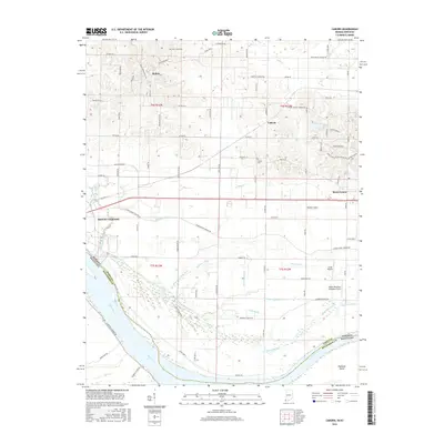
2016 Map of Caborn
USGS Topo · Published 2016About this map
The Ohio River curves along the southern border of this Posey County landscape, defining the state boundary between Indiana and Kentucky. This riverine environment is characterized by an extensive network of drainage infrastructure, including the Dixon and Lewis Ditch, Blue Pond Ditch, and Crunk Ditch, which manage the low-lying terrain north of the river. These channels navigate a landscape dotted with wetlands like Goose Pond and Cypress Slough, which frame the large landmass of Diamond Island in the river's main channel.
Find a feature on this map
77 named features on this map. Tap any name to fly to it.
Don’t see what you’re looking for? This feature index may not catch every label — zoom into the map to look around manually.
Map Details
Editions of this 2016 Caborn Map
This is the sole edition of this map. No revisions or reprints were ever made.
Other maps of this area

1901 · Haubstadt
USGS Topo · 1:62,500

1903 · Haubstadt
USGS Topo · 1:62,500

1903 · New Harmony
USGS Topo · 1:62,500

1903 · Patoka
USGS Topo · 1:125,000

1914 · Henderson
USGS Topo · 1:48,000

1916 · Henderson
USGS Topo · 1:62,500

1917 · Uniontown
USGS Topo · 1:62,500

1938 · New Harmony
USGS Topo · 1:62,500
1952 · Mount Vernon
USGS Topo · 1:24,000
1952 · Wilson
USGS Topo · 1:24,000