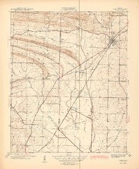
1941 Map of Cabot
USGS Topo · Published 1945About this map
Cabot stands as the primary rail hub on this 1941 survey, anchored by the Missouri Pacific railroad as it cuts through the undulating landscape of Lonoke and Pulaski Counties. The area is defined by a dense network of rural community centers, including Holland and the distinctive Quapaw Mineral Springs. A high concentration of country churches serves the surrounding farmsteads, with landmarks such as Pleasant Valley Ch, Mt Tabor Ch, and Ebenezer Ch marking the social geography of the era.
Find a feature on this map
31 named features on this map. Tap any name to fly to it.
Don’t see what you’re looking for? This feature index may not catch every label — zoom into the map to look around manually.
Map Details
Editions of this 1941 Cabot Map
2 editions found
Other maps of this area

1891 · Little Rock
USGS Topo · 1:125,000

1893 · Little Rock
USGS Topo · 1:125,000

1935 · Mc Almont
USGS Topo · 1:24,000

1940 · Lonoke
USGS Topo · 1:62,500

1941 · Olmstead
USGS Topo · 1:31,680

1941 · Cabot
USGS Topo · 1:31,680

1943 · Jacksonville
USGS Topo · 1:31,680

1948 · Helena
USGS Topo · 1:250,000

1949 · Lonoke
USGS Topo · 1:62,500

1950 · Helena
USGS Topo · 1:250,000