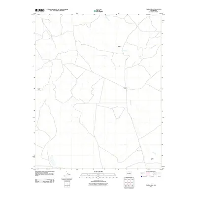
2010 Map of Cabra Hill
USGS Topo · Published 2010About this map
Salitre and the high desert landscape of San Miguel County characterize this northern New Mexico quadrangle. The terrain is defined by a sparse network of ranching outposts and ephemeral waterways, most notably where the Conchas River winds through the central portion of the sheet. The convergence of Salitre Creek and other local drainage patterns reflects the essential role of water in this arid environment, providing the necessary geography for the established Cabra Springs Ranch and Conchas Ranch.
Find a feature on this map
9 named features on this map. Tap any name to fly to it.
Don’t see what you’re looking for? This feature index may not catch every label — zoom into the map to look around manually.
Map Details
Editions of this 2010 Cabra Hill Map
This is the sole edition of this map. No revisions or reprints were ever made.
Other maps of this area

1892 · Corazon
USGS Topo · 1:125,000

1894 · Corazon
USGS Topo · 1:125,000

1954 · Santa Fe
USGS Topo · 1:250,000

1958 · Santa Fe
USGS Topo · 1:250,000

1963 · Cactus Tank
USGS Topo · 1:24,000

1963 · Mesa Cherisco
USGS Topo · 1:24,000
1963 · Horse Pasture Tank
USGS Topo · 1:24,000
1963 · Bar Y Ranch
USGS Topo · 1:24,000

1963 · Flagstone Mountain
USGS Topo · 1:24,000
1972 · Cabra Hill
USGS Topo · 1:24,000