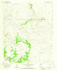
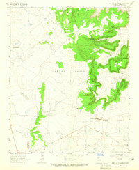
1963 Map of Horse Pasture Tank
USGS Topo · Published 1965About this map
Preston Beck and the surrounding ranchlands within the Anton Chico Grant characterize this high-desert landscape in the early 1960s. The region is defined by a series of isolated stock tanks and camps, including Alamito Camp and Colonias Camp, which supported the livestock industry along the northern reaches of the Pecos River. The terrain is marked by winding drainages such as Alamito Creek and Esteros Creek, feeding into a network of small water sources like Horse Pasture Tank, Lucky Tank, and Chalky Tank.
Find a feature on this map
26 named features on this map. Tap any name to fly to it.
Don’t see what you’re looking for? This feature index may not catch every label — zoom into the map to look around manually.
Map Details
Editions of this 1963 Horse Pasture Tank Map
2 editions found
Other maps of this area

1892 · Corazon
USGS Topo · 1:125,000

1894 · Corazon
USGS Topo · 1:125,000

1954 · Santa Fe
USGS Topo · 1:250,000

1958 · Santa Fe
USGS Topo · 1:250,000

1963 · Colonias
USGS Topo · 1:24,000

1963 · Pedro Miguel Peak
USGS Topo · 1:24,000

1963 · Cactus Tank
USGS Topo · 1:24,000
1963 · Catfish Falls
USGS Topo · 1:24,000
1963 · Bar Y Ranch
USGS Topo · 1:24,000
1963 · Mesita De Guadalupe
USGS Topo · 1:24,000