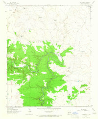
1963 Map of Catfish Falls
USGS Topo · Published 1965About this map
The Pecos River carves a deep, winding path through this corner of New Mexico, dominated by large land grants and ranching infrastructure. The map details the complex boundaries of the Anton Chico Grant, Preston Beck, and the Jose Perea holdings. The river's dramatic course is marked by the sharp turn of Horseshoe Bend and the eponymous Catfish Falls.
Find a feature on this map
28 named features on this map. Tap any name to fly to it.
Don’t see what you’re looking for? This feature index may not catch every label — zoom into the map to look around manually.
Map Details
Editions of this 1963 Catfish Falls Map
This is the sole edition of this map. No revisions or reprints were ever made.
Other maps of this area

1892 · Corazon
USGS Topo · 1:125,000

1894 · Corazon
USGS Topo · 1:125,000

1954 · Santa Fe
USGS Topo · 1:250,000

1954 · Fort Sumner
USGS Topo · 1:250,000

1958 · Fort Sumner
USGS Topo · 1:250,000

1958 · Santa Fe
USGS Topo · 1:250,000

1963 · Colonias
USGS Topo · 1:24,000

1963 · Santa Rosa
USGS Topo · 1:24,000

1963 · Sunshine Mesa
USGS Topo · 1:24,000

1963 · Mesa Cherisco
USGS Topo · 1:24,000