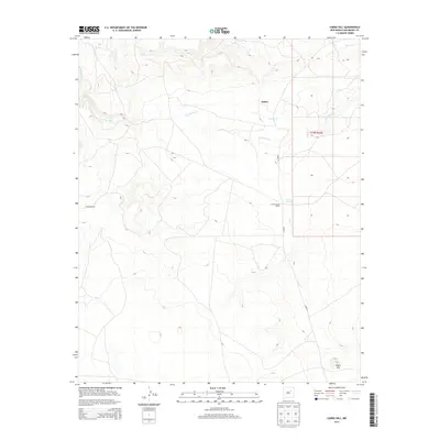
2013 Map of Cabra Hill
USGS Topo · Published 2013About this map
Salitre serves as a focal point in this high-plains landscape of eastern San Miguel County, where ranching operations and water sources dictate the pattern of human settlement. The map traces the winding course of the Conchas River as it receives drainage from Salitre Cr and Cabra Cr, providing vital water to the arid terrain. Land use is characterized by established homesteads and livestock operations, including Conchas Ranch and the Cabra Springs Ranch located near the namesake Cabra Springs. In the southeastern corner, the prominent rise of Cabra Hill overlooks the surrounding plains, providing a significant landmark for navigation. This survey provides a modern view of the enduring rural character of the region, detailing the network of local ranch roads like Creek 1A that link these isolated settlements.
Find a feature on this map
10 named features on this map. Tap any name to fly to it.
Don’t see what you’re looking for? This feature index may not catch every label — zoom into the map to look around manually.
Map Details
Editions of this 2013 Cabra Hill Map
This is the sole edition of this map. No revisions or reprints were ever made.
Other maps of this area

1892 · Corazon
USGS Topo · 1:125,000

1894 · Corazon
USGS Topo · 1:125,000

1954 · Santa Fe
USGS Topo · 1:250,000

1958 · Santa Fe
USGS Topo · 1:250,000

1963 · Cactus Tank
USGS Topo · 1:24,000

1963 · Mesa Cherisco
USGS Topo · 1:24,000
1963 · Horse Pasture Tank
USGS Topo · 1:24,000
1963 · Bar Y Ranch
USGS Topo · 1:24,000

1963 · Flagstone Mountain
USGS Topo · 1:24,000
1972 · Cabra Hill
USGS Topo · 1:24,000