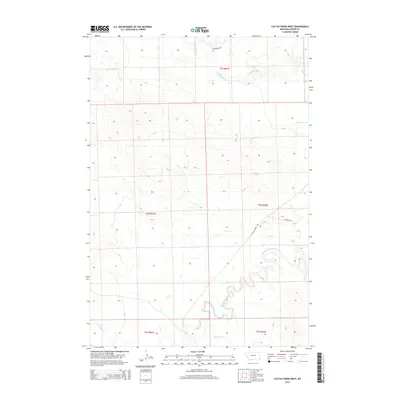
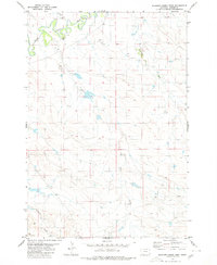
2014 Map of Cactus Creek West
USGS Topo · Published 2014About this map
The Little Missouri River meanders across this southeastern corner of Montana, carving a complex drainage network through the high plains of Carter County. This 2014 survey reveals a landscape defined by its riparian arteries and the large-scale grid of the Public Land Survey System. Tributaries such as Cactus Cr and Cottonwood Cr feed into the river system, which remains the primary geological and geographical anchor for the region. The map highlights the sparse infrastructure of the early 21st century, where the local economy and movement are channeled along routes like Little Missouri Rd and Bickerdyke Rd. This area, characterized by its drainages like Plum Cr and Elkhorn Cr, provides a detailed look at the ranching and range land layout in one of the state's most easterly reaches, bordering the North Dakota and South Dakota lines.
Find a feature on this map
15 named features on this map. Tap any name to fly to it.
Don’t see what you’re looking for? This feature index may not catch every label — zoom into the map to look around manually.
Map Details
Editions of this 2014 Cactus Creek West Map
This is the sole edition of this map. No revisions or reprints were ever made.
Other maps of this area

1954 · Ekalaka
USGS Topo · 1:250,000

1956 · Ekalaka
USGS Topo · 1:250,000

1958 · Ekalaka
USGS Topo · 1:250,000

1965 · Ekalaka
USGS Topo · 1:250,000

1980 · Cactus Creek West
USGS Topo · 1:24,000

1980 · Finger Buttes East
USGS Topo · 1:24,000
1980 · Albion
USGS Topo · 1:24,000
1980 · Elkhorn Creek East
USGS Topo · 1:24,000
1980 · Capitol NW
USGS Topo · 1:24,000
1980 · Elkhorn Creek West
USGS Topo · 1:24,000