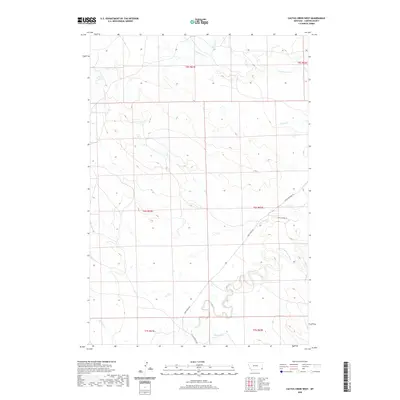
2020 Map of Cactus Creek West
USGS Topo · Published 2020About this map
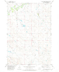
The Little Missouri River meanders deeply through this section of Carter County, shaping the drainage patterns for numerous seasonal and permanent tributaries. The landscape is defined by the hydrologic network of Cactus Cr, Cottonwood Cr, and Elkhorn Cr, which carve through the high plains terrain. This 2020 USGS survey illustrates a sparsely populated ranching or grazing region where the road network is dictated by the river's path and local topography. Grounded by established routes like Camp Crook Rd and Little Missouri Rd, the map provides an essential look at contemporary land divisions and water access in southeastern Montana. Smaller features like Blacktail Cr and Plum Cr further delineate the watershed, offering a precise view of the physical environment in this corner of the state.
Find a feature on this map
16 named features on this map. Tap any name to fly to it.
Don’t see what you’re looking for? This feature index may not catch every label — zoom into the map to look around manually.
Map Details
Editions of this 2020 Cactus Creek West Map
This is the sole edition of this map. No revisions or reprints were ever made.
Other maps of this area

1954 · Ekalaka
USGS Topo · 1:250,000

1956 · Ekalaka
USGS Topo · 1:250,000

1958 · Ekalaka
USGS Topo · 1:250,000

1965 · Ekalaka
USGS Topo · 1:250,000

1980 · Cactus Creek West
USGS Topo · 1:24,000

1980 · Finger Buttes East
USGS Topo · 1:24,000
1980 · Albion
USGS Topo · 1:24,000
1980 · Elkhorn Creek East
USGS Topo · 1:24,000
1980 · Capitol NW
USGS Topo · 1:24,000
1980 · Elkhorn Creek West
USGS Topo · 1:24,000