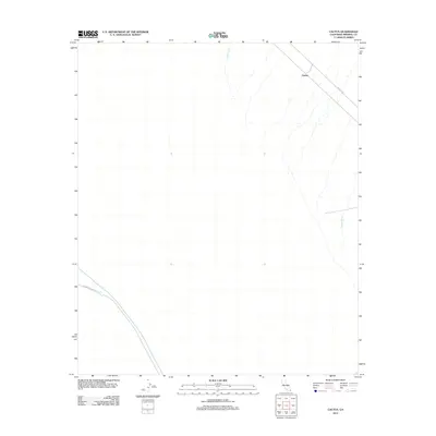
2012 Map of Cactus
USGS Topo · Published 2012About this map
Cactus marks the primary point of settlement on this high-desert map, situated at a junction of rail and road. The landscape is defined by the vital movement of water through the arid Imperial County terrain, most notably via the Coachella Canal which sweeps across the southwestern portion of the sheet. At Drop One, the infrastructure managing this artificial waterway becomes visible, illustrating the engineering required to sustain agriculture and habitation in this environment. To the north and east, the natural drainage patterns of Indian Wash and Tumco Wash create a network of ephemeral stream beds that cross the path of Ted Kipf Rd. These features collectively reveal the intersection of modern hydraulic engineering and the harsh, natural hydrology of the California desert.
Find a feature on this map
7 named features on this map. Tap any name to fly to it.
Don’t see what you’re looking for? This feature index may not catch every label — zoom into the map to look around manually.
Map Details
Editions of this 2012 Cactus Map
This is the sole edition of this map. No revisions or reprints were ever made.
Other maps of this area

1903 · Yuma
USGS Topo · 1:125,000

1905 · Yuma
USGS Topo · 1:125,000

1907 · Holtville
USGS Topo · 1:125,000

1942 · El Centro
USGS Topo · 1:250,000

1942 · Yuma
USGS Topo · 1:250,000

1953 · Grays Well
USGS Topo · 1:24,000

1953 · Ogilby
USGS Topo · 1:62,500

1953 · Cactus
USGS Topo · 1:24,000
1953 · Grays Well NE
USGS Topo · 1:24,000

1954 · El Centro
USGS Topo · 1:250,000