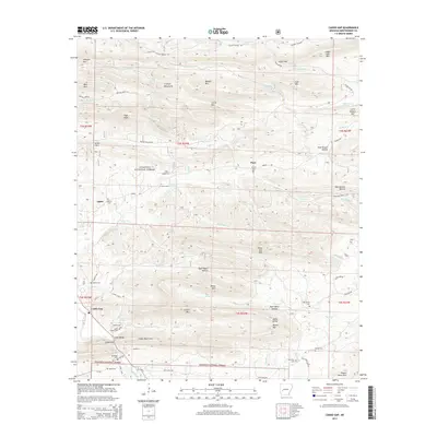
2014 Map of Caddo Gap
USGS Topo · Published 2014About this map
Caddo Gap serves as a focal point in the southern portion of this region, where the Caddo River carves through the prominent Caddo Mountains. The landscape is defined by the dense ridges of the Ouachita National Forest, with settlements like Jones Valley, Ophir, and Plata dotting the valleys and foothills. Numerous family and community burial sites, including Bethel Cem, Jones Valley Cem, and Mt Zion Cem, are scattered across the terrain, reflecting the deep genealogical roots of this part of Montgomery County.
Find a feature on this map
77 named features on this map. Tap any name to fly to it.
Don’t see what you’re looking for? This feature index may not catch every label — zoom into the map to look around manually.
Map Details
Editions of this 2014 Caddo Gap Map
This is the sole edition of this map. No revisions or reprints were ever made.
Other maps of this area

1890 · Mount Ida
USGS Topo · 1:125,000

1890 · Hot Springs
USGS Topo · 1:125,000

1894 · Hot Springs
USGS Topo · 1:125,000

1906 · Caddo Gap
USGS Topo · 1:125,000

1936 · Glenwood
USGS Topo · 1:48,000

1942 · Glenwood
USGS Topo · 1:62,500

1949 · Glenwood
USGS Topo · 1:62,500

1955 · Little Rock
USGS Topo · 1:250,000

1956 · Little Rock
USGS Topo · 1:250,000

1959 · Mount Ida
USGS Topo · 1:62,500