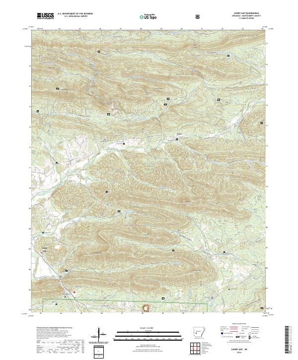
2024 Map of Caddo Gap
USGS Topo · Published 2024About this map
The Caddo River winds through the southwestern corner of this survey, defining the lower valley where the settlement of Caddo Gap is situated. This region is dominated by the ridges of the Ouachita National Forest, including the Crystal Mountains and the Caddo Mountains. The landscape is characterized by narrow valleys and steep mountainsides, with small communities and family burial sites tucked into the level ground near watercourses like Gap Creek and Mazarn Creek. For genealogists and local historians, the map serves as a detailed record of rural life, marking numerous isolated cemeteries such as Bethel Cem, Jones Valley Cem, and Strawn Springs Cem. The presence of several springs, including Collier Spring and Buttermilk Spring, highlights the importance of natural water sources in this upland terrain. This modern survey provides a clear view of the complex topography that has shaped settlement patterns in Montgomery County for generations.
Find a feature on this map
74 named features on this map. Tap any name to fly to it.
Don’t see what you’re looking for? This feature index may not catch every label — zoom into the map to look around manually.
Map Details
Editions of this 2024 Caddo Gap Map
This is the sole edition of this map. No revisions or reprints were ever made.
Other maps of this area

1890 · Mount Ida
USGS Topo · 1:125,000

1890 · Hot Springs
USGS Topo · 1:125,000

1894 · Hot Springs
USGS Topo · 1:125,000

1906 · Caddo Gap
USGS Topo · 1:125,000

1936 · Glenwood
USGS Topo · 1:48,000

1942 · Glenwood
USGS Topo · 1:62,500

1949 · Glenwood
USGS Topo · 1:62,500

1955 · Little Rock
USGS Topo · 1:250,000

1956 · Little Rock
USGS Topo · 1:250,000

1959 · Mount Ida
USGS Topo · 1:62,500