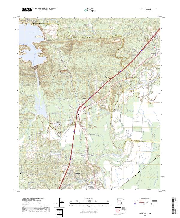
2024 Map of Caddo Valley
USGS Topo · Published 2024About this map
The Ouachita River and Caddo River converge in this central Arkansas landscape, creating a geography defined by its waterways. To the north, the waters of De Gray Lake reach into the terrain, while the city of Arkadelphia anchors the southern portion of the map. This area serves as an academic and community hub, notably featuring the campus of Henderson State University.
Find a feature on this map
124 named features on this map. Tap any name to fly to it.
Don’t see what you’re looking for? This feature index may not catch every label — zoom into the map to look around manually.
Map Details
Editions of this 2024 Caddo Valley Map
This is the sole edition of this map. No revisions or reprints were ever made.
Other maps of this area

1948 · Malvern
USGS Topo · 1:62,500

1949 · Malvern
USGS Topo · 1:62,500

1955 · Little Rock
USGS Topo · 1:250,000

1956 · Little Rock
USGS Topo · 1:250,000

1959 · Caddo Valley
USGS Topo · 1:24,000

1959 · Arkadelphia
USGS Topo · 1:24,000

1960 · Little Rock
USGS Topo · 1:250,000

1964 · Little Rock
USGS Topo · 1:250,000

1964 · Donaldson
USGS Topo · 1:24,000
1965 · Dalark
USGS Topo · 1:24,000