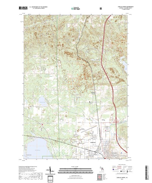
2023 Map of Cadillac North
USGS Topo · Published 2023About this map
Cadillac serves as the focal point of this northern Michigan landscape, where the urban grid meets the recreational and timber lands of the Manistee National Forest. The map documents a complex interface of civic infrastructure and natural features, from the Wexford County Courthouse and Wexford County Airport to the expansive waters of Lake Mitchell and the winding Clam River. North of the city, smaller communities like Haring and Missaukee Junction are situated along the Bus 131 corridor, reflecting the region's historical and modern transportation patterns.
Find a feature on this map
91 named features on this map. Tap any name to fly to it.
Don’t see what you’re looking for? This feature index may not catch every label — zoom into the map to look around manually.
Map Details
Editions of this 2023 Cadillac North Map
This is the sole edition of this map. No revisions or reprints were ever made.
Other maps of this area

1954 · Traverse City
USGS Topo · 1:250,000

1956 · Mesick
USGS Topo · 1:62,500

1956 · Cadillac North
USGS Topo · 1:62,500

1957 · Cadillac South
USGS Topo · 1:62,500

1957 · Luther
USGS Topo · 1:62,500

1958 · Traverse City
USGS Topo · 1:250,000

1983 · Cadillac
USGS Topo · 1:100,000

1983 · Manton
USGS Topo · 1:25,000

1983 · Cadillac North
USGS Topo · 1:24,000
1983 · Cadillac South
USGS Topo · 1:25,000
Featured Places
- Cadillac, MI
- Haring Township, MI
- Haring Charter Township, Haring Township
- Selma Township, MI
- Cedar Creek Township, MI