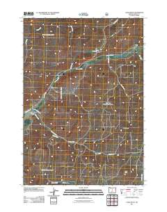
2011 Map of Cadle Butte
USGS Topo · Published 2011About this map
Keystone Ranch and the small settlement at Howard anchor this landscape in the high desert country of Crook County. The drainage network is the primary defining feature of the area, with Ochoco Creek and Marks Creek converging near the center of the sheet, joined by numerous seasonal and perennial tributaries like Veazie Creek and Camp Branch. This water-driven topography dictates the placement of early ranching infrastructure and the winding paths of rural routes like SE Keystone Ranch Rd and Arvid Nelson Rd.
Find a feature on this map
19 named features on this map. Tap any name to fly to it.
Don’t see what you’re looking for? This feature index may not catch every label — zoom into the map to look around manually.
Map Details
Editions of this 2011 Cadle Butte Map
This is the sole edition of this map. No revisions or reprints were ever made.
Other maps of this area

1946 · Eagle Rock
USGS Topo · 1:62,500

1948 · Eagle Rock
USGS Topo · 1:62,500

1948 · Ochoco Reservoir
USGS Topo · 1:62,500

1950 · Ochoco Reservoir
USGS Topo · 1:62,500

1951 · Post
USGS Topo · 1:62,500

1951 · Lookout Mtn
USGS Topo · 1:62,500

1955 · Bend
USGS Topo · 1:250,000

1957 · Bend
USGS Topo · 1:250,000

1958 · Bend
USGS Topo · 1:250,000

1981 · Prineville
USGS Topo · 1:100,000