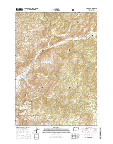
2014 Map of Cadle Butte
USGS Topo · Published 2014About this map
The high elevation terrain of the Ochoco Mountains dominates this portion of the Ochoco National Forest in central Oregon. This landscape is defined by its deep drainage networks and volcanic peaks, including Cadle Butte and Valpey Butte in the southeast. Significant watercourses like Marks Cr and Veazie Cr carve through the forested ridges, following the natural contours of the land.
Find a feature on this map
61 named features on this map. Tap any name to fly to it.
Don’t see what you’re looking for? This feature index may not catch every label — zoom into the map to look around manually.
Map Details
Editions of this 2014 Cadle Butte Map
This is the sole edition of this map. No revisions or reprints were ever made.
Other maps of this area

1946 · Eagle Rock
USGS Topo · 1:62,500

1948 · Eagle Rock
USGS Topo · 1:62,500

1948 · Ochoco Reservoir
USGS Topo · 1:62,500

1950 · Ochoco Reservoir
USGS Topo · 1:62,500

1951 · Post
USGS Topo · 1:62,500

1951 · Lookout Mtn
USGS Topo · 1:62,500

1955 · Bend
USGS Topo · 1:250,000

1957 · Bend
USGS Topo · 1:250,000

1958 · Bend
USGS Topo · 1:250,000

1981 · Prineville
USGS Topo · 1:100,000