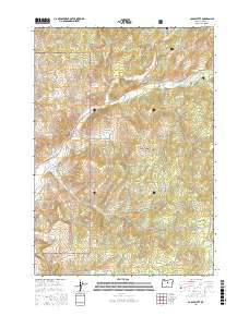
2017 Map of Cadle Butte
USGS Topo · Published 2017About this map
Dixie Meadows sits at the southern edge of this high-altitude landscape within the Ochoco National Forest in central Oregon. Mapped in 2017, the terrain is defined by a complex network of seasonal drainages and named watercourses like Salmon Cr and Peterson Cr. This area of Crook County reflects the managed forest and ranching heritage of the region, where modern road systems and land-use boundaries overlay a rugged, topographically diverse environment. The map preserves the specific spatial relationship between these natural water features and the established grazing lands and meadows that have historically supported the local rural economy.
Find a feature on this map
3 named features on this map. Tap any name to fly to it.
Don’t see what you’re looking for? This feature index may not catch every label — zoom into the map to look around manually.
Map Details
Editions of this 2017 Cadle Butte Map
This is the sole edition of this map. No revisions or reprints were ever made.
Other maps of this area

1946 · Eagle Rock
USGS Topo · 1:62,500

1948 · Eagle Rock
USGS Topo · 1:62,500

1948 · Ochoco Reservoir
USGS Topo · 1:62,500

1950 · Ochoco Reservoir
USGS Topo · 1:62,500

1951 · Post
USGS Topo · 1:62,500

1951 · Lookout Mtn
USGS Topo · 1:62,500

1955 · Bend
USGS Topo · 1:250,000

1957 · Bend
USGS Topo · 1:250,000

1958 · Bend
USGS Topo · 1:250,000

1981 · Prineville
USGS Topo · 1:100,000