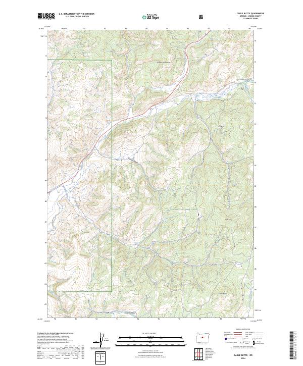
2024 Map of Cadle Butte
USGS Topo · Published 2024About this map
The Ochoco National Forest dominates this section of Crook County, where the high-elevation terrain of the Ochoco Mountains gives rise to a complex drainage system. Central to the geography is Ochoco Creek, which is fed by numerous tributaries including Marks Creek, Salmon Creek, and Camp Branch. The landscape is punctuated by significant volcanic features such as Cadle Butte and Volpey Butte, which stand as prominent landmarks for those navigating the timbered slopes. Evidence of land use is visible in the network of forest roads and specific access routes like Arvid Nelson Rd and Se Keystone Ranch Rd. Towards the southern reaches, the land levels out into Dixie Meadows, a natural clearing along Lawson Creek that contrasts with the surrounding ridgelines and the steep-sided Watkins Hollow.
Find a feature on this map
21 named features on this map. Tap any name to fly to it.
Don’t see what you’re looking for? This feature index may not catch every label — zoom into the map to look around manually.
Map Details
Editions of this 2024 Cadle Butte Map
This is the sole edition of this map. No revisions or reprints were ever made.
Other maps of this area

1946 · Eagle Rock
USGS Topo · 1:62,500

1948 · Eagle Rock
USGS Topo · 1:62,500

1948 · Ochoco Reservoir
USGS Topo · 1:62,500

1950 · Ochoco Reservoir
USGS Topo · 1:62,500

1951 · Post
USGS Topo · 1:62,500

1951 · Lookout Mtn
USGS Topo · 1:62,500

1955 · Bend
USGS Topo · 1:250,000

1957 · Bend
USGS Topo · 1:250,000

1958 · Bend
USGS Topo · 1:250,000

1981 · Prineville
USGS Topo · 1:100,000