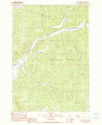
1990 Map of Cadle Butte
USGS Topo · Published 1990About this map
The Ochoco Mountains define the character of this interior Oregon landscape, where the Ochoco National Forest boundary separates managed timberland from private agricultural holdings. In the late 20th century, this area remained defined by its ranching history and isolated homesteads. The Keystone Ranch sits along the southern hills, while small named locales such as Watkins, Marks, and Ochoco follow the narrow drainage of Ochoco Creek as it winds through the mountains. These small clusters of structures represent the sparse but vital settlement pattern of Crook County, anchored to the water sources and grazing lands. Geologic features like Cadle Butte and Valpey Butte serve as primary landmarks for land navigation, while the complex network of creeks, including Veazie Creek and Lawson Creek, reveals the drainage pattern of the southern Ochoco range. The transition from the high ridges down to Dixie Meadows illustrates the local reliance on alluvial plains for seasonal livestock use and early homesteading.
Find a feature on this map
21 named features on this map. Tap any name to fly to it.
Don’t see what you’re looking for? This feature index may not catch every label — zoom into the map to look around manually.
Map Details
Editions of this 1990 Cadle Butte Map
This is the sole edition of this map. No revisions or reprints were ever made.
Other maps of this area

1946 · Eagle Rock
USGS Topo · 1:62,500

1948 · Eagle Rock
USGS Topo · 1:62,500

1948 · Ochoco Reservoir
USGS Topo · 1:62,500

1950 · Ochoco Reservoir
USGS Topo · 1:62,500

1951 · Post
USGS Topo · 1:62,500

1951 · Lookout Mtn
USGS Topo · 1:62,500

1955 · Bend
USGS Topo · 1:250,000

1957 · Bend
USGS Topo · 1:250,000

1958 · Bend
USGS Topo · 1:250,000

1981 · Prineville
USGS Topo · 1:100,000