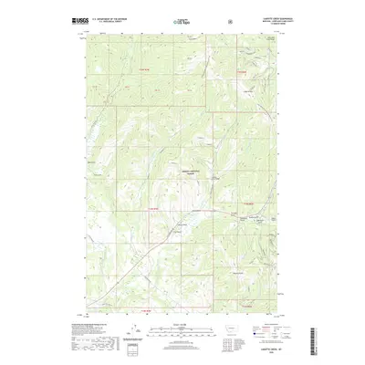
2020 Map of Cadotte Creek
USGS Topo · Published 2020About this map
Cadotte Pass serves as a primary geographic anchor in this section of the Lewis and Clark Range, where high-elevation terrain dictates the movement of water and travelers alike. The Continental Divide National Scenic Trail winds through the eastern portion of the Helena National Forest, tracing the ridge line above a series of drainages including Surveyors Gulch and Whiskey Gulch. To the south, the industrial history of the region is evident near the Blackfoot River headwaters, where mining operations such as Mikehorse and the Paymaster 1 mine are situated. The map illustrates a landscape of narrow gulches and creek beds, with Alice Cr and Cadotte Cr carving deep paths through the timbered slopes. Notable infrastructure, such as the Cadotte Creek Bridge and E MT Highway 200, highlights the modern connectivity through this otherwise challenging mountain environment.
Find a feature on this map
59 named features on this map. Tap any name to fly to it.
Don’t see what you’re looking for? This feature index may not catch every label — zoom into the map to look around manually.
Map Details
Editions of this 2020 Cadotte Creek Map
This is the sole edition of this map. No revisions or reprints were ever made.
Other maps of this area

1889 · Helena
USGS Topo · 1:250,000

1893 · Helena
USGS Topo · 1:250,000

1899 · Helena
USGS Topo · 1:250,000

1903 · Coopers Lake
USGS Topo · 1:125,000

1903 · Helena
USGS Topo · 1:250,000

1943 · Hogan
USGS Topo · 1:125,000

1947 · Butte
USGS Topo · 1:250,000

1955 · Choteau
USGS Topo · 1:250,000

1957 · Choteau
USGS Topo · 1:250,000

1958 · Butte
USGS Topo · 1:250,000