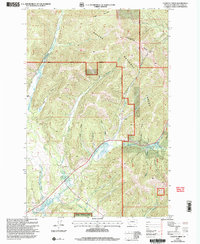
2001 Map of Cadotte Creek
USGS Topo · Published 2004About this map
The Continental Divide forms a high-altitude spine through this section of the Helena National Forest, marking the watershed split where Cadotte Pass and Rogers Pass provided critical early transit routes through the mountains. The landscape is defined by a dense network of gulches and creeks, including Cadotte Creek and Alice Creek, which feed into the Blackfoot River system.
Find a feature on this map
32 named features on this map. Tap any name to fly to it.
Don’t see what you’re looking for? This feature index may not catch every label — zoom into the map to look around manually.
Map Details
Editions of this 2001 Cadotte Creek Map
This is the sole edition of this map. No revisions or reprints were ever made.
Other maps of this area

1889 · Helena
USGS Topo · 1:250,000

1893 · Helena
USGS Topo · 1:250,000

1899 · Helena
USGS Topo · 1:250,000

1903 · Coopers Lake
USGS Topo · 1:125,000

1903 · Helena
USGS Topo · 1:250,000

1943 · Hogan
USGS Topo · 1:125,000

1947 · Butte
USGS Topo · 1:250,000

1955 · Choteau
USGS Topo · 1:250,000

1957 · Choteau
USGS Topo · 1:250,000

1958 · Butte
USGS Topo · 1:250,000