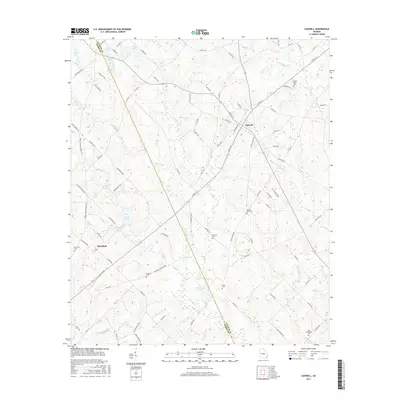
2017 Map of Cadwell
USGS Topo · Published 2017About this map
Cadwell and Plainfield serve as the primary hubs of this rural south-central Georgia landscape, where the boundary between Laurens Co and Dodge Co angles across the terrain. The area is defined by a dense network of local routes, such as Old Eastman Rd and Whittle Rd, which connect numerous family-named landmarks and historical burial grounds. Several small water bodies, including Whittle Lake, Bryan Lake, and Jones Pond, dot the region alongside an intricate system of creeks like Alligator Cr and Batson Cr. For the genealogist or local historian, the map preserves the exact locations of several secluded cemeteries, such as Joseph Mullis Cem, Daniels Gift Cem, and New Providence Cem. The transition from the town center of Cadwell out to the agricultural fields and timber stands of the surrounding countryside is clearly documented, illustrating the persistent rural character of this portion of the coastal plain.
Find a feature on this map
92 named features on this map. Tap any name to fly to it.
Don’t see what you’re looking for? This feature index may not catch every label — zoom into the map to look around manually.
Map Details
Editions of this 2017 Cadwell Map
This is the sole edition of this map. No revisions or reprints were ever made.
Other maps of this area

1957 · Macon
USGS Topo · 1:250,000

1958 · Macon
USGS Topo · 1:250,000

1964 · Macon
USGS Topo · 1:250,000

1972 · Eastman
USGS Topo · 1:24,000

1972 · Mc Rae NW
USGS Topo · 1:24,000

1972 · Jay Bird Springs
USGS Topo · 1:24,000

1973 · Cadwell
USGS Topo · 1:24,000

1974 · Chester
USGS Topo · 1:24,000

1974 · Five Points
USGS Topo · 1:24,000

1974 · Rentz
USGS Topo · 1:24,000