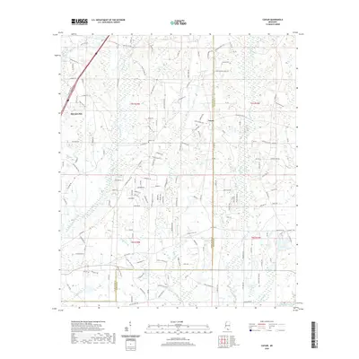
2020 Map of Caesar
USGS Topo · Published 2020About this map
Caesar sits at the heart of this coastal Mississippi landscape, marking a rural crossroads along the Pearl River Co Hancock Co line. The terrain is defined by an intricate network of waterways draining toward the Gulf, including the meandering paths of East Hobolochitto Cr and Catahoula Cr. To the northwest, the edge of Picayune begins to show the transition from dense forest and swamp drainage to established municipal development.
Find a feature on this map
154 named features on this map. Tap any name to fly to it.
Don’t see what you’re looking for? This feature index may not catch every label — zoom into the map to look around manually.
Map Details
Editions of this 2020 Caesar Map
This is the sole edition of this map. No revisions or reprints were ever made.
Other maps of this area

1914 · Nicholson
USGS Topo · 1:62,500

1921 · Nicholson
USGS Topo · 1:62,500

1941 · Honey Island
USGS Topo · 1:31,680

1953 · Mobile
USGS Topo · 1:250,000

1955 · Savannah
USGS Topo · 1:62,500

1955 · Nicholson
USGS Topo · 1:24,000

1957 · Mobile
USGS Topo · 1:250,000

1957 · Dead Tiger Creek
USGS Topo · 1:24,000

1958 · Picayune
USGS Topo · 1:62,500
1959 · Kiln
USGS Topo · 1:24,000