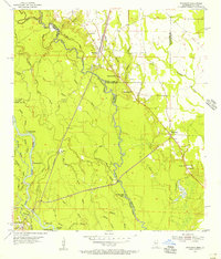
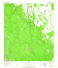
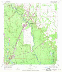
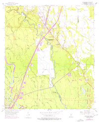
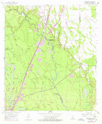
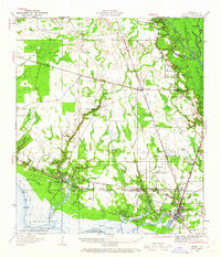
1955 Map of Nicholson
USGS Topo · Published 1956About this map
The Pearl River forms a complex hydrologic border between Mississippi and Louisiana in the mid-1950s, defining a landscape of deep bayous and braided channels. Along the Southern railroad corridor, the settlement of Nicholson serves as a primary inland landmark, supported by local community hubs like Red Hill Ch and Cedar Grove Ch. The interior is marked by an intricate network of named water bodies, including Indian Bayou, Turkey Lake, and Murdock Eddy Lake, reflecting a region where transport and life were dictated by the river’s path. Small rural clusters like Santa Rosa and Murree are situated away from the floodplains, while the presence of several Gravel Pits indicates the active extraction industry of the era. Genealogists will find value in the specific locations of parish and county boundaries near Corinth Ch and the isolated Turtleskin Cem.
Find a feature on this map
58 named features on this map. Tap any name to fly to it.
Don’t see what you’re looking for? This feature index may not catch every label — zoom into the map to look around manually.
Map Details
Editions of this 1955 Nicholson Map
5 editions found
Other maps of this area

1914 · Nicholson
USGS Topo · 1:62,500

1921 · Nicholson
USGS Topo · 1:62,500

1935 · Slidell
USGS Topo · 1:62,500

1939 · Slidell
USGS Topo · 1:62,500

1941 · Honey Island
USGS Topo · 1:31,680

1942 · Walkiah Bluff
USGS Topo · 1:31,680

1950 · Haaswood
USGS Topo · 1:31,680
1950 · Slidell
USGS Topo · 1:62,500

1953 · Mobile
USGS Topo · 1:250,000

1954 · Haaswood
USGS Topo · 1:31,680