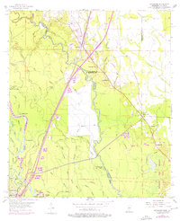
1955 Map of Nicholson
USGS Topo · Published 1976About this map
Pearl River and its intricate network of bayous form the backbone of this borderland landscape between Mississippi and Louisiana. The Southern railroad line runs parallel to the river, anchoring the community of Nicholson and providing a transportation corridor through the dense wetlands. The map reveals a transition in land use by the mid-1970s, as traditional Gravel Pits and timberlands near Santa Rosa sit adjacent to the large NASA Test Facility in the southeast.
Find a feature on this map
59 named features on this map. Tap any name to fly to it.
Don’t see what you’re looking for? This feature index may not catch every label — zoom into the map to look around manually.
Map Details
Editions of this 1955 Nicholson Map
5 editions found

Other maps of this area

1914 · Nicholson
USGS Topo · 1:62,500

1921 · Nicholson
USGS Topo · 1:62,500

1935 · Slidell
USGS Topo · 1:62,500

1939 · Slidell
USGS Topo · 1:62,500

1941 · Honey Island
USGS Topo · 1:31,680

1942 · Walkiah Bluff
USGS Topo · 1:31,680

1950 · Haaswood
USGS Topo · 1:31,680

1950 · Slidell
USGS Topo · 1:62,500

1953 · Mobile
USGS Topo · 1:250,000

1954 · Haaswood
USGS Topo · 1:31,680