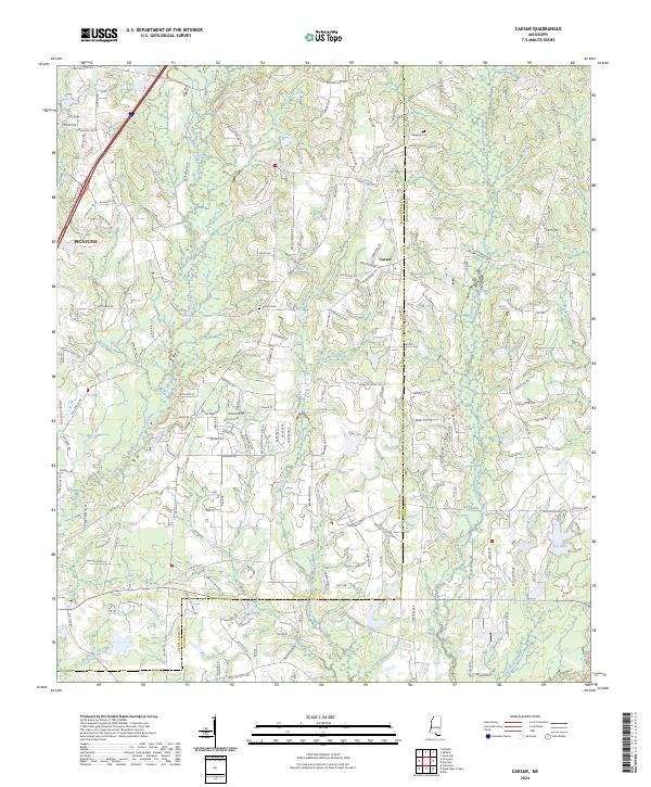
2024 Map of Caesar
USGS Topo · Published 2024About this map
The settlement of Caesar and the eastern edge of Picayune anchor this landscape along the border of Pearl River and Hancock counties. This 2024 USGS survey documents a region defined by a dense network of tributaries including East Hobolochitto Creek, Catahoula Creek, and Mill Creek, illustrating the intricate drainage patterns of the coastal plain. Family names and local history are preserved in markers like Pearson Cem and Gipson Cem, which remain as distinct landmarks amidst the residential roads and rural tracts.
Find a feature on this map
153 named features on this map. Tap any name to fly to it.
Don’t see what you’re looking for? This feature index may not catch every label — zoom into the map to look around manually.
Map Details
Editions of this 2024 Caesar Map
This is the sole edition of this map. No revisions or reprints were ever made.
Other maps of this area

1914 · Nicholson
USGS Topo · 1:62,500

1921 · Nicholson
USGS Topo · 1:62,500

1941 · Honey Island
USGS Topo · 1:31,680

1953 · Mobile
USGS Topo · 1:250,000

1955 · Savannah
USGS Topo · 1:62,500

1955 · Nicholson
USGS Topo · 1:24,000

1957 · Mobile
USGS Topo · 1:250,000

1957 · Dead Tiger Creek
USGS Topo · 1:24,000

1958 · Picayune
USGS Topo · 1:62,500
1959 · Kiln
USGS Topo · 1:24,000