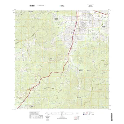
2018 Map of Caguas
USGS Topo · Published 2018About this map
Caguas anchors this dense interior region of the Island of Puerto Rico, where the urban center meets the steep elevations of the Central Mountain Range. The 2018 landscape is defined by a significant educational and civic infrastructure, featuring the Universidad Del Turabo, EDIC College, and the Escuela de Medicina San Juan Bautista. Major transportation arteries, including the Autopista Luis A Ferre and Expreso Cruz Ortiz Stella, facilitate movement through the river valleys of the Rio Turabo and Rio Cañaboncito.
Find a feature on this map
55 named features on this map. Tap any name to fly to it.
Don’t see what you’re looking for? This feature index may not catch every label — zoom into the map to look around manually.
Map Details
Editions of this 2018 Caguas Map
This is the sole edition of this map. No revisions or reprints were ever made.
Other maps of this area

1946 · Patillas
USGS Topo · 1:30,000

1946 · Aguas Buenas
USGS Topo · 1:30,000

1946 · Cayey
USGS Topo · 1:30,000

1946 · Comerio
USGS Topo · 1:30,000

1946 · Naranjito
USGS Topo · 1:30,000

1946 · Gurabo
USGS Topo · 1:30,000

1946 · Juncos
USGS Topo · 1:30,000

1946 · Yabucoa
USGS Topo · 1:30,000

1946 · Caguas
USGS Topo · 1:30,000
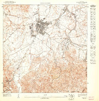
1947 · Caguas NE
USGS Topo · 1:10,000
Featured Places
- Caguas
- Sector Héctor Rivera, Caguas
- Sector Parcelas Cañaboncito, Caguas
- Sector Los Flamboyanes (Cañaboncito), Caguas
- Sector Cruz Garay, Aguas Buenas