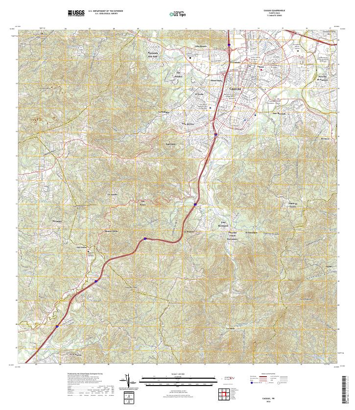
2024 Map of Caguas
USGS Topo · Published 2024About this map
Caguas serves as the central hub of this inland Puerto Rican landscape, where dense urban development transitions into the steep hillsides of the Cordillera Central. The map details a complex network of residential sectors and neighborhoods including Villa Blanca, El Condado, and Villa del Rey, alongside significant institutional centers such as the Centro Judicial de Caguas. The terrain is deeply carved by numerous waterways, with the Río Turabo and Río Caguitas winding through the valley floor. Educational and religious landmarks are prominent throughout the region, ranging from the National University College Recinto de Caguas and the Escuela de Medicina San Juan Bautista to the sprawling Cementerio Monte Calvario and Cementerio Jardín del Edén. Beyond the city center, the topography rises sharply toward peaks like Cerro Las Piñas, illustrating the geographical constraints that have shaped the growth of communities like Tomás de Castro and Jagual.
Find a feature on this map
78 named features on this map. Tap any name to fly to it.
Don’t see what you’re looking for? This feature index may not catch every label — zoom into the map to look around manually.
Map Details
Editions of this 2024 Caguas Map
This is the sole edition of this map. No revisions or reprints were ever made.
Other maps of this area

1946 · Patillas
USGS Topo · 1:30,000

1946 · Aguas Buenas
USGS Topo · 1:30,000

1946 · Cayey
USGS Topo · 1:30,000

1946 · Comerio
USGS Topo · 1:30,000

1946 · Naranjito
USGS Topo · 1:30,000

1946 · Gurabo
USGS Topo · 1:30,000

1946 · Juncos
USGS Topo · 1:30,000

1946 · Yabucoa
USGS Topo · 1:30,000

1946 · Caguas
USGS Topo · 1:30,000
1947 · Caguas NE
USGS Topo · 1:10,000
Featured Places
- Caguas
- Sector Héctor Rivera, Caguas
- Sector Parcelas Cañaboncito, Caguas
- Sector Los Quintana, Caguas
- Sector Los Flamboyanes (Cañaboncito), Caguas