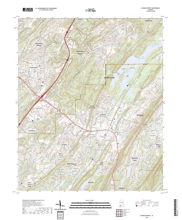
2024 Map of Cahaba Heights
USGS Topo · Published 2024About this map
Cahaba River and its major tributaries, including the Little Cahaba River, anchor this modern topography of the suburban transition south of Birmingham. The landscape is defined by long, northeast-southwest ridges such as Dolly Ridge, Rocky Ridge, and the massive Oak Mountain and New Hope Mountain formations. These ridges have historically constrained development, funneling infrastructure into gaps like Bailey Gap and Brasier Gap. The map documents the dense residential growth of Mountain Brook, Vestavia Hills, and Hoover alongside legacy landmarks.
Find a feature on this map
74 named features on this map. Tap any name to fly to it.
Don’t see what you’re looking for? This feature index may not catch every label — zoom into the map to look around manually.
Map Details
Editions of this 2024 Cahaba Heights Map
This is the sole edition of this map. No revisions or reprints were ever made.
Other maps of this area

1889 · Birmingham
USGS Topo · 1:125,000

1890 · Bessemer
USGS Topo · 1:125,000

1892 · Birmingham
USGS Topo · 1:125,000

1892 · Bessemer
USGS Topo · 1:125,000

1895 · Birmingham
USGS Topo · 1:125,000

1904 · Birmingham Coal District
USGS Topo · 1:62,500

1905 · Bessemer Iron District
USGS Topo · 1:62,500

1905 · Leeds
USGS Topo · 1:62,500

1906 · Birmingham Special
USGS Topo · 1:62,500

1906 · Vandiver
USGS Topo · 1:62,500