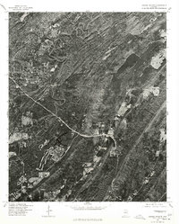
1975 Map of Cahaba Heights
USGS Topo · Published 1977About this map
Mountain Brook and Cahaba Heights are captured here during a period of significant suburban development in the mid-1970s. This orthophotograph, produced by the Geological Survey in cooperation with the Soil Conservation Service, uses imagery from December 1975 to provide a detailed overhead view of the residential patterns and expanding infrastructure south of Birmingham. The visual data highlights the winding road networks and cleared land tracts characteristic of Alabama's post-war suburban growth, where forested ridges meet new housing developments. This specific edition serves as a bridge between traditional topographic mapping and pure aerial photography, offering a direct visual record of the landscape's transformation before later decades of densification.
Find a feature on this map
2 named features on this map. Tap any name to fly to it.
Don’t see what you’re looking for? This feature index may not catch every label — zoom into the map to look around manually.
Map Details
Editions of this 1975 Cahaba Heights Map
This is the sole edition of this map. No revisions or reprints were ever made.
Other maps of this area

1889 · Birmingham
USGS Topo · 1:125,000

1890 · Bessemer
USGS Topo · 1:125,000

1892 · Birmingham
USGS Topo · 1:125,000

1892 · Bessemer
USGS Topo · 1:125,000

1895 · Birmingham
USGS Topo · 1:125,000

1904 · Birmingham Coal District
USGS Topo · 1:62,500

1905 · Bessemer Iron District
USGS Topo · 1:62,500

1905 · Leeds
USGS Topo · 1:62,500

1906 · Birmingham Special
USGS Topo · 1:62,500

1906 · Vandiver
USGS Topo · 1:62,500