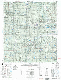
2003 Map of Caiman Creek
USGS Topo · Published 2003About this map
Nueces River drainage patterns define this landscape in South Texas, where a complex network of waterways including Caiman Creek, Los Olmos Creek, and Chupadero Creek converge. The terrain is characterized by broad brush country and scrub, punctuated by the distinct elevation of Monte Cortado. Local history is anchored by the Fort Ewell Historical Monument situated near the riverbanks, marking the site of a mid-19th-century frontier outpost. The map reveals a land utilized for both historical preservation and modern industry, shown through various Gravel pits and several specialized landing sites like the Heliport and multiple soft-surface airfields. The boundary between La Salle Co and Webb Co runs through the southern portion of the survey, crossing over Live Oak Creek and Dolores Creek in an area primarily defined by large ranch holdings and natural hydrology.
Find a feature on this map
16 named features on this map. Tap any name to fly to it.
Don’t see what you’re looking for? This feature index may not catch every label — zoom into the map to look around manually.
Map Details
Editions of this 2003 Caiman Creek Map
This is the sole edition of this map. No revisions or reprints were ever made.
Other maps of this area

1927 · Bart
USGS Topo · 1:62,500

1929 · Cotulla
USGS Topo · 1:125,000

1940 · Cotulla
USGS Topo · 1:62,500

1940 · Artesia Wells
USGS Topo · 1:62,500

1942 · Fowlerton
USGS Topo · 1:62,500

1953 · Crystal City
USGS Topo · 1:250,000

1955 · Crystal City
USGS Topo · 1:250,000

1956 · Becerra
USGS Topo · 1:62,500

1956 · Piedra Creek
USGS Topo · 1:62,500

1956 · Webb
USGS Topo · 1:62,500