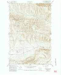
1948 Map of Cairn Hope Peak
USGS Topo · Published 1984About this map
The Yakima Firing Center Military Reservation dominates much of this landscape, reflecting the mid-century expansion of military training grounds in central Washington. This 1948 survey shows a high desert terrain defined by the structural ridges of Umtanum Ridge and the Rattlesnake Hills, separated by the broad floor of Black Rock Valley. The map records a series of established ranching outposts, including Taylor Ranch and Meeboer Ranch, which mark the sparse settlement pattern of the region before further modernization. Small-scale human impact is evident at the Gravel Pit and along Riley Road, while the local history of the valley is anchored by the Black Rock Cem near the southern boundary. To the north, the summit of Cairn Hope Peak provides a high-ground vantage point overlooking the drainage of Cold Creek.
Find a feature on this map
19 named features on this map. Tap any name to fly to it.
Don’t see what you’re looking for? This feature index may not catch every label — zoom into the map to look around manually.
Map Details
Editions of this 1948 Cairn Hope Peak Map
3 editions found
Other maps of this area

1910 · Zillah
USGS Topo · 1:125,000

1915 · Prosser
USGS Topo · 1:125,000

1917 · Priest Rapids
USGS Topo · 1:62,500

1917 · Prosser
USGS Topo · 1:125,000

1936 · Hog Ranch Buttes
USGS Topo · 1:48,000

1941 · Black Rock Spring
USGS Topo · 1:62,500

1948 · Cairn Hope Peak
USGS Topo · 1:24,000

1948 · Emerson Nipple
USGS Topo · 1:24,000

1948 · Priest Rapids
USGS Topo · 1:24,000

1950 · Yakima
USGS Topo · 1:250,000