
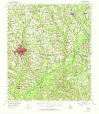
1956 Map of Cairo
USGS Topo · Published 1957About this map
Cairo serves as the primary hub of this south Georgia landscape, situated at the junction of the Atlantic Coast Line railroad and the Franklin D Roosevelt Highway. The mid-century terrain is defined by a dense network of tributaries including Little Tired Creek and Barnetts Creek, which feed into the Ochlockonee River. Rural life is anchored by numerous small communities and landmark institutions, from Pierce Chapel and Centennial Ch to local education centers like Midway Sch and Union Sch. Industrial activity is evident in the Silica Strip Mines found in the southwestern corner, while smaller settlements like Pine Park, Ochlocknee, and Akridge are scattered along the rail line and backroads. The map illustrates a transitional period of growth, featuring the Cairo Airport and a Drive-in Theater just outside the main town center.
Find a feature on this map
71 named features on this map. Tap any name to fly to it.
Don’t see what you’re looking for? This feature index may not catch every label — zoom into the map to look around manually.
Map Details
Editions of this 1956 Cairo Map
2 editions found
Other maps of this area

1953 · Dothan
USGS Topo · 1:250,000

1953 · Waycross
USGS Topo · 1:250,000

1954 · Dothan
USGS Topo · 1:250,000

1954 · Valdosta
USGS Topo · 1:250,000

1954 · Tallahassee
USGS Topo · 1:250,000

1955 · Dothan
USGS Topo · 1:250,000

1955 · Whigham
USGS Topo · 1:62,500

1956 · Metcalf
USGS Topo · 1:24,000

1956 · Calvary
USGS Topo · 1:24,000

1957 · Beachton
USGS Topo · 1:24,000