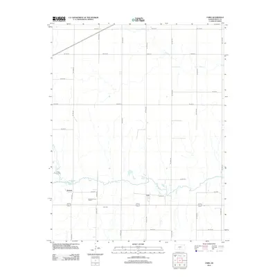
2012 Map of Cairo
USGS Topo · Published 2012About this map
The S Fork Ninnescah River meanders across this Pratt County landscape, anchoring a rural district defined by small settlements and energy production. The community of Cairo serves as a central point near the river's path, while the small settlement of Waldeck sits further west. This area represents a classic Kansas agricultural and industrial mix, where the section-line road grid organizes both traditional farmsteads and active extraction sites like the Barnes Southwest Oil Field. Local history is preserved at the Cairo Cem, situated just south of the primary east-west corridor. Smaller waterways such as Coon Cr and Silver Cr drain the northern and southern plains, carving subtle variations into the prairie terrain between the dispersed homesteads.
Find a feature on this map
31 named features on this map. Tap any name to fly to it.
Don’t see what you’re looking for? This feature index may not catch every label — zoom into the map to look around manually.
Map Details
Editions of this 2012 Cairo Map
This is the sole edition of this map. No revisions or reprints were ever made.
Other maps of this area

1892 · Kingman
USGS Topo · 1:125,000

1892 · Pratt
USGS Topo · 1:125,000

1894 · Kingman
USGS Topo · 1:125,000

1894 · Pratt
USGS Topo · 1:125,000

1955 · Pratt
USGS Topo · 1:250,000

1959 · Pratt
USGS Topo · 1:250,000

1966 · Cunningham
USGS Topo · 1:24,000
1966 · St Leo
USGS Topo · 1:24,000

1967 · Cairo
USGS Topo · 1:24,000

1968 · Pratt SW
USGS Topo · 1:24,000