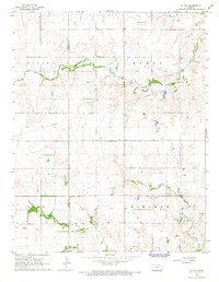
1966 Map of St Leo
USGS Topo · Published 1968About this map
The St Leo community serves as the primary focal point in this portion of Kansas, situated near the confluence where the North Fork Chikaskia River meets the main Chikaskia River. This 1960s survey illustrates a landscape defined by its agricultural and resource-based economy, with the boundary between Pratt Co and Kingman Co running vertically through the western sections. Evidence of local industry is visible through multiple Gravel Pits and an isolated Oil Well, indicating the subsurface extraction common to the region during this era.
Find a feature on this map
14 named features on this map. Tap any name to fly to it.
Don’t see what you’re looking for? This feature index may not catch every label — zoom into the map to look around manually.
Map Details
Editions of this 1966 St Leo Map
This is the sole edition of this map. No revisions or reprints were ever made.
Other maps of this area

1889 · Anthony
USGS Topo · 1:125,000

1891 · Medicine Lodge
USGS Topo · 1:125,000

1891 · Anthony
USGS Topo · 1:125,000

1892 · Kingman
USGS Topo · 1:125,000

1892 · Pratt
USGS Topo · 1:125,000

1893 · Medicine Lodge
USGS Topo · 1:125,000

1894 · Kingman
USGS Topo · 1:125,000

1894 · Pratt
USGS Topo · 1:125,000

1955 · Pratt
USGS Topo · 1:250,000

1959 · Pratt
USGS Topo · 1:250,000