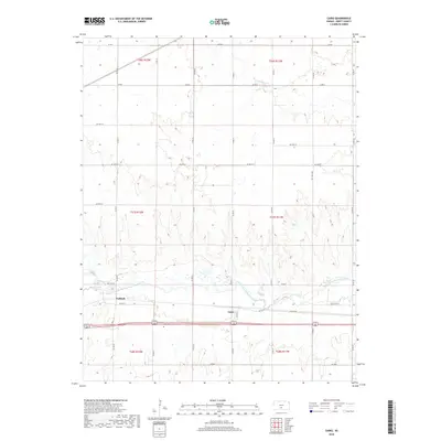
2018 Map of Cairo
USGS Topo · Published 2018About this map
The South Fork Ninnescah River meanders eastward through the center of this Pratt County landscape, defining the local geography between the small settlements of Cairo and Waldeck. Historically significant for local families and genealogists, the Cairo Cem sits just south of the river valley, marking a point of long-standing community connection. The terrain is characterized by the broad alluvial plain of the Ninnescah and its tributaries, including Coon Cr to the south and Silver Cr to the north. A grid of county roads, such as Co RD 25 and Co RD 26, provides a look at the organized land use and rural development of the late twenty-first century. This survey documents the intersection of natural watercourses and the established transport network that has sustained these small Kansas farming hubs for generations.
Find a feature on this map
32 named features on this map. Tap any name to fly to it.
Don’t see what you’re looking for? This feature index may not catch every label — zoom into the map to look around manually.
Map Details
Editions of this 2018 Cairo Map
This is the sole edition of this map. No revisions or reprints were ever made.
Other maps of this area

1892 · Kingman
USGS Topo · 1:125,000

1892 · Pratt
USGS Topo · 1:125,000

1894 · Kingman
USGS Topo · 1:125,000

1894 · Pratt
USGS Topo · 1:125,000

1955 · Pratt
USGS Topo · 1:250,000

1959 · Pratt
USGS Topo · 1:250,000

1966 · Cunningham
USGS Topo · 1:24,000
1966 · St Leo
USGS Topo · 1:24,000

1967 · Cairo
USGS Topo · 1:24,000

1968 · Pratt SW
USGS Topo · 1:24,000