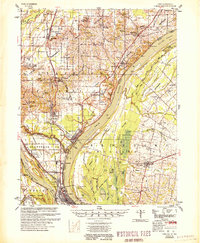
1955 Map of Cairo
USGS Topo · Published 1955About this map
The confluence of the Ohio River and Mississippi River defines this 1955 survey, where the strategic city of Cairo sits at the southern tip of Illinois. The landscape is heavily influenced by water management and river trade, with the Cache River winding through the northern portion and numerous sloughs and ponds, such as Swan Pond and Fish Lake, dotting the floodplain. The area's mid-century transit infrastructure is exceptionally detailed, showing the convergence of major rail lines like the Illinois Central and Louisville and Nashville, alongside local landmarks like the Cairo Airport.
Find a feature on this map
95 named features on this map. Tap any name to fly to it.
Don’t see what you’re looking for? This feature index may not catch every label — zoom into the map to look around manually.
Map Details
Editions of this 1955 Cairo Map
This is the sole edition of this map. No revisions or reprints were ever made.
Other maps of this area

1918 · Vienna
USGS Topo · 1:62,500

1919 · Vienna
USGS Topo · 1:62,500

1920 · Jonesboro
USGS Topo · 1:62,500

1920 · Dongola
USGS Topo · 1:62,500

1923 · Dongola
USGS Topo · 1:62,500

1923 · Jonesboro
USGS Topo · 1:62,500

1928 · La Center
USGS Topo · 1:62,500

1931 · Cairo
USGS Topo · 1:62,500

1932 · La Center
USGS Topo · 1:62,500

1933 · Cairo
USGS Topo · 1:62,500