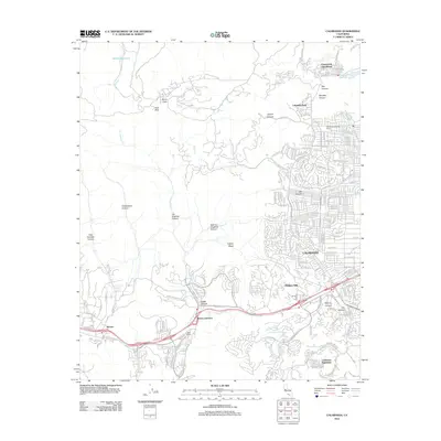
2012 Map of Calabasas
USGS Topo · Published 2012About this map
Calabasas and the western San Fernando Valley margins are defined here by a transition from dense residential grids to the deeply etched drainage basins of the Simi Hills. The map traces the winding paths of Las Virgenes Cr and Bell Cr through numerous named canyons, illustrating how the area's development is dictated by the steep topography. Notable land use includes the Los Angeles Pet Cem near the southern hills and large-scale water management features like Chatsworth Reservoir and Runkle Reservoir. Small enclaves such as Chatsworth Lake Manor and Hidden Hills sit alongside commercial hubs at Brents Junction and Agoura. The landscape remains marked by large holdings like Gebel Ranch and Rancho Sombra Del Roble, reflecting the region's ranching heritage even as suburban expansion reaches into East Las Virgenes Canyon and up toward Calabasas Highlands.
Find a feature on this map
91 named features on this map. Tap any name to fly to it.
Don’t see what you’re looking for? This feature index may not catch every label — zoom into the map to look around manually.
Map Details
Editions of this 2012 Calabasas Map
This is the sole edition of this map. No revisions or reprints were ever made.
Other maps of this area

1900 · Triunfo Pass
USGS Topo · 1:62,500

1900 · Piru
USGS Topo · 1:62,500

1903 · Calabasas
USGS Topo · 1:62,500

1903 · Camulos
USGS Topo · 1:125,000

1903 · Santa Susana
USGS Topo · 1:62,500

1921 · Piru
USGS Topo · 1:62,500

1921 · Triunfo Pass
USGS Topo · 1:62,500

1925 · Chatsworth
USGS Topo · 1:24,000

1927 · Chatsworth
USGS Topo · 1:24,000

1928 · Dry Canyon
USGS Topo · 1:24,000