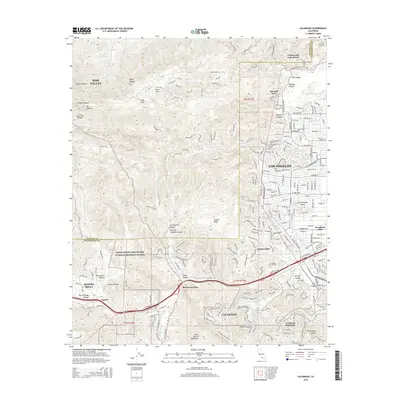
2015 Map of Calabasas
USGS Topo · Published 2015About this map
Santa Monica Mountains National Recreation Area dominates the southern and central terrain of this quadrangle, illustrating the preservation of open space amidst the dense residential growth of the western San Fernando Valley. The map documents the complex boundary between Ventura and Los Angeles counties, where suburban enclaves like Hidden Hills and Bell Canyon meet the high ridges of the Simi Hills. Established communities such as Calabasas and Agoura Hills are shown along the busy corridor of Ventura Blvd, reflecting the area's development as a premier residential and recreational hub. Water management is a visible priority, with the Chatsworth Reservoir and Runkle Reservoir situated among numerous canyons, including Meier Canyon and Box Canyon, that define the local topography.
Find a feature on this map
59 named features on this map. Tap any name to fly to it.
Don’t see what you’re looking for? This feature index may not catch every label — zoom into the map to look around manually.
Map Details
Editions of this 2015 Calabasas Map
This is the sole edition of this map. No revisions or reprints were ever made.
Other maps of this area

1900 · Triunfo Pass
USGS Topo · 1:62,500

1900 · Piru
USGS Topo · 1:62,500

1903 · Calabasas
USGS Topo · 1:62,500

1903 · Camulos
USGS Topo · 1:125,000

1903 · Santa Susana
USGS Topo · 1:62,500

1921 · Piru
USGS Topo · 1:62,500

1921 · Triunfo Pass
USGS Topo · 1:62,500

1925 · Chatsworth
USGS Topo · 1:24,000

1927 · Chatsworth
USGS Topo · 1:24,000

1928 · Dry Canyon
USGS Topo · 1:24,000