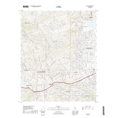
2018 Map of Calabasas
USGS Topo · Published 2018About this map
The Simi Hills and the northern reaches of the Santa Monica Mountains National Recreation Area define this landscape on the boundary of Ventura and Los Angeles counties. Established residential enclaves such as Hidden Hills and Lakeside Park sit adjacent to expansive open spaces crisscrossed by historical routes, including the Juan Bautista de Anza National Historic Trail and the Ahmanson Ranch House Trail. The map documents a complex interface between suburban development in Los Angeles and the protected terrain of Laskey Mesa and Cheseboro Canyon.
Find a feature on this map
67 named features on this map. Tap any name to fly to it.
Don’t see what you’re looking for? This feature index may not catch every label — zoom into the map to look around manually.
Map Details
Editions of this 2018 Calabasas Map
This is the sole edition of this map. No revisions or reprints were ever made.
Other maps of this area

1900 · Triunfo Pass
USGS Topo · 1:62,500

1900 · Piru
USGS Topo · 1:62,500

1903 · Calabasas
USGS Topo · 1:62,500

1903 · Camulos
USGS Topo · 1:125,000

1903 · Santa Susana
USGS Topo · 1:62,500

1921 · Piru
USGS Topo · 1:62,500

1921 · Triunfo Pass
USGS Topo · 1:62,500

1925 · Chatsworth
USGS Topo · 1:24,000

1927 · Chatsworth
USGS Topo · 1:24,000

1928 · Dry Canyon
USGS Topo · 1:24,000