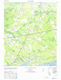
1953 Map of Calabash
USGS Topo · Published 1953About this map
Calabash sits at the heart of this coastal borderlands landscape, where the North Carolina South Carolina state line cuts diagonally through the saltwater marshes and timber tracts. The area is defined by its massive swamp systems and shallow basins, including Waccamaw Swamp, Doghead Bay, and Drowned Bay. These wetlands are interlaced with early road networks such as Old Tram Road and Wampee Road, signaling a history of maritime commerce and land exploitation.
Find a feature on this map
57 named features on this map. Tap any name to fly to it.
Don’t see what you’re looking for? This feature index may not catch every label — zoom into the map to look around manually.
Map Details
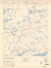
Editions of this 1953 Calabash Map
2 editions found
Other maps of this area

1943 · Little River
USGS Topo · 1:31,680

1943 · Pireway
USGS Topo · 1:31,680

1943 · Calabash
USGS Topo · 1:31,680

1943 · Wampee
USGS Topo · 1:24,000

1943 · Freeland
USGS Topo · 1:24,000

1943 · Exum
USGS Topo · 1:24,000

1943 · Shallotte
USGS Topo · 1:24,000

1944 · Longs
USGS Topo · 1:31,680

1944 · Shallotte
USGS Topo · 1:31,680

1949 · Georgetown
USGS Topo · 1:250,000