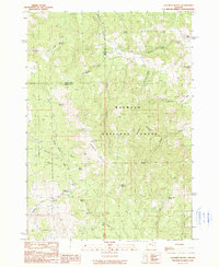
1990 Map of Calamity Butte
USGS Topo · Published 1990About this map
Calamity Butte serves as the central landmark for this high-elevation landscape within the Malheur National Forest, where the boundary between Grant and Harney counties dissects the terrain. The map reveals a complex network of hydrological features, from the headwaters of Calamity Creek and Beaverdam Creek to numerous named springs such as Tin Can Spring and Oard Spring. The drainage patterns, including Brophy Canyon and Elbow Canyon, define the movement through these highlands. Human presence is sparse, indicated primarily by isolated markers of ranching and land use such as the Wade Ranch, H&V Cabin, and Potts Field. The concentration of family-named water sources and flats like Jackknife Flat suggests a history of seasonal grazing and forest management in a region defined by its water scarcity and specific topographic points of interest.
Find a feature on this map
35 named features on this map. Tap any name to fly to it.
Don’t see what you’re looking for? This feature index may not catch every label — zoom into the map to look around manually.
Map Details
Editions of this 1990 Calamity Butte Map
This is the sole edition of this map. No revisions or reprints were ever made.
Other maps of this area

1955 · Burns
USGS Topo · 1:250,000

1955 · Canyon City
USGS Topo · 1:250,000

1958 · Burns
USGS Topo · 1:250,000

1959 · Burns
USGS Topo · 1:250,000

1959 · Canyon City
USGS Topo · 1:250,000

1961 · Calamity Butte
USGS Topo · 1:62,500

1961 · Logan Valley
USGS Topo · 1:62,500

1961 · Seneca
USGS Topo · 1:62,500

1968 · Van
USGS Topo · 1:62,500

1978 · John Day
USGS Topo · 1:100,000