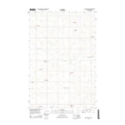
2014 Map of Calamity Coulee
USGS Topo · Published 2014About this map
Calamity Coulee and its neighboring drainage systems define this landscape in Garfield County, Montana. The terrain is deeply incised by complex watercourses including Skunk Arroyo and Hawks Nest Cr, which feed into the larger prairie network. This 2014 survey reveals a territory primarily shaped by natural topography rather than dense human settlement, with numerous family-named landmarks such as Nighten Helser Coulee, Ogilvie Coulee, and Todd Coulee indicating the historical footprint of early ranching and land claims in the Big Dry region.
Find a feature on this map
17 named features on this map. Tap any name to fly to it.
Don’t see what you’re looking for? This feature index may not catch every label — zoom into the map to look around manually.
Map Details
Editions of this 2014 Calamity Coulee Map
This is the sole edition of this map. No revisions or reprints were ever made.
Other maps of this area

1954 · Jordan
USGS Topo · 1:250,000

1954 · Forsyth
USGS Topo · 1:250,000

1956 · Jordan
USGS Topo · 1:250,000

1957 · Forsyth
USGS Topo · 1:250,000

1958 · Jordan
USGS Topo · 1:250,000

1958 · Forsyth
USGS Topo · 1:250,000

1964 · Jordan
USGS Topo · 1:250,000

1965 · Cohagen
USGS Topo · 1:24,000

1965 · Whiteside Ranch
USGS Topo · 1:24,000

1965 · Calamity Coulee
USGS Topo · 1:24,000