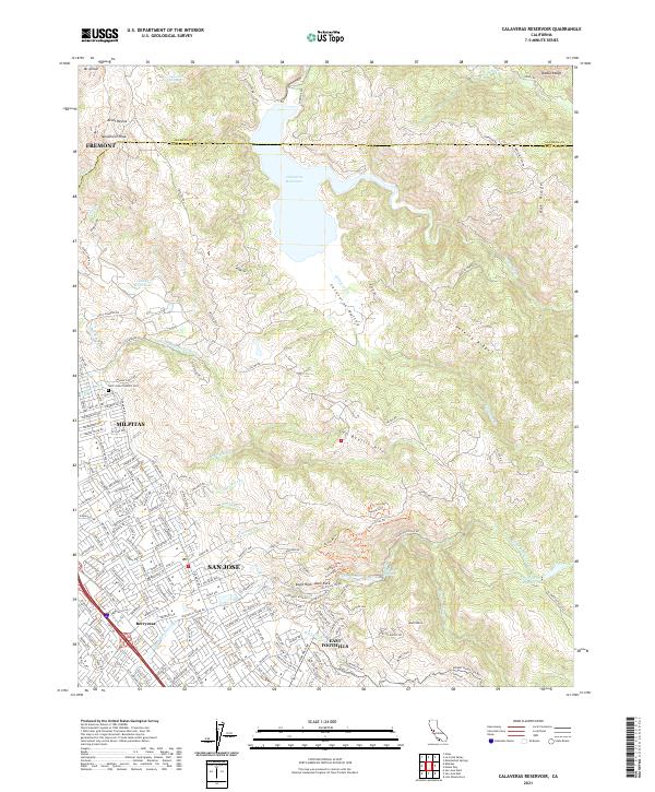
2021 Map of Calaveras Reservoir
USGS Topo · Published 2021About this map
The eastern edges of San Jose and Milpitas meet the rising slopes of the Diablo Range in this recent survey. Urban residential growth in Berryessa and the East Foothills transitions into a network of watershed lands and mountain peaks. Centered on the Calaveras Reservoir, the map traces the critical water infrastructure of the S Bay Aqueduct and the drainages of Arroyo Hondo and Calaveras Cr. Local history is anchored by Saint Johns Catholic Cem and the recreational geography of Alum Rock Canyon. High points like Monument Peak and Mt Allison define the horizon above the Calaveras Valley, illustrating the persistent divide between the dense Santa Clara Valley floor and the protected open spaces of the Los Buellis Hills.
Find a feature on this map
155 named features on this map. Tap any name to fly to it.
Don’t see what you’re looking for? This feature index may not catch every label — zoom into the map to look around manually.
Map Details
Editions of this 2021 Calaveras Reservoir Map
This is the sole edition of this map. No revisions or reprints were ever made.
Other maps of this area

1889 · San Jose
USGS Topo · 1:62,500

1897 · San Jose
USGS Topo · 1:62,500

1897 · Mt. Hamilton
USGS Topo · 1:62,500

1899 · San Jose
USGS Topo · 1:62,500

1906 · Pleasanton
USGS Topo · 1:62,500

1907 · Tesla
USGS Topo · 1:62,500

1941 · Pleasanton
USGS Topo · 1:62,500

1942 · Mt. Hamilton
USGS Topo · 1:62,500

1942 · Altamont
USGS Topo · 1:62,500

1943 · Pleasanton
USGS Topo · 1:62,500