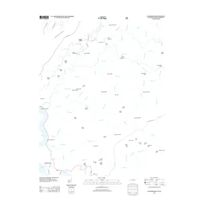
2013 Map of Calderwood
USGS Topo · Published 2013About this map
Calderwood sits along the southern edge of this landscape, positioned near the waters of Chilhowee Lake and the winding course of the Foothills Pkwy. The terrain is defined by a dense network of ridges and gaps, including Happy Valley Ridge and Abrams Ridge, which shelter small settlements like Happy Valley. This area preserves the names of early inhabitants and crossings, such as Gourley Ford and Shaw Grave Gap, reflecting a history of movement through the gaps in the Great Smoky Mountains foothills.
Find a feature on this map
102 named features on this map. Tap any name to fly to it.
Don’t see what you’re looking for? This feature index may not catch every label — zoom into the map to look around manually.
Map Details
Editions of this 2013 Calderwood Map
This is the sole edition of this map. No revisions or reprints were ever made.
Other maps of this area

1886 · Knoxville
USGS Topo · 1:125,000

1892 · Knoxville
USGS Topo · 1:125,000

1893 · Murphy
USGS Topo · 1:125,000

1894 · Knoxville
USGS Topo · 1:125,000

1895 · Loudon
USGS Topo · 1:125,000

1895 · Knoxville
USGS Topo · 1:125,000

1901 · Knoxville
USGS Topo · 1:125,000

1914 · Murphy
USGS Topo · 1:125,000

1933 · Haw Knob
USGS Topo · 1:48,000

1933 · Whiteoak Flats
USGS Topo · 1:24,000