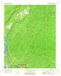
1964 Map of Calderwood
USGS Topo · Published 1967About this map
Great Smoky Mountains National Park dominates this mid-1960s landscape, bordering the managed waters of the Little Tennessee River. The map captures a moment when industrial utility met recreation, showing the infrastructure of Chilhowee Lake and Calderwood Lake alongside the remote heights of Hannah Mountain. The small settlement of Calderwood sits at the river’s edge, while Happy Valley provides a pocket of habitation to the north, anchored by Chilhowee Ch.
Find a feature on this map
100 named features on this map. Tap any name to fly to it.
Don’t see what you’re looking for? This feature index may not catch every label — zoom into the map to look around manually.
Map Details
Editions of this 1964 Calderwood Map
3 editions found
Other maps of this area

1886 · Knoxville
USGS Topo · 1:125,000

1892 · Knoxville
USGS Topo · 1:125,000

1893 · Murphy
USGS Topo · 1:125,000

1894 · Knoxville
USGS Topo · 1:125,000

1895 · Loudon
USGS Topo · 1:125,000

1895 · Knoxville
USGS Topo · 1:125,000

1901 · Knoxville
USGS Topo · 1:125,000

1914 · Murphy
USGS Topo · 1:125,000

1933 · Haw Knob
USGS Topo · 1:48,000

1933 · Whiteoak Flats
USGS Topo · 1:24,000