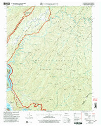
2003 Map of Calderwood
USGS Topo · Published 2004About this map
Great Smoky Mountains National Park dominates the rugged landscape of this 2002 revision, where the crests of Hannah Mountain and Chilhowee Mountain define a region of deep hollows and narrow gaps. The settlement of Calderwood sits along the southern reaches of Chilhowee Lake and Calderwood Lake, reflecting the hydroelectric development of the Little Tennessee River. Genealogists may find value in the small mountain community of Happy Valley, which remains marked by the Chilhowee Ch and various cemeteries tucked into the ridges. The terrain is crisscrossed by historic routes like Cooper Road and Parson Branch Road, which provide access to interior landmarks such as Abrams Falls. This sheet also traces the winding path of the Foothills Parkway as it skirts the park boundary, offering overlooks that capture the elevation changes from Grassy Flats to the high point at Parson Bald.
Find a feature on this map
103 named features on this map. Tap any name to fly to it.
Don’t see what you’re looking for? This feature index may not catch every label — zoom into the map to look around manually.
Map Details
Editions of this 2003 Calderwood Map
This is the sole edition of this map. No revisions or reprints were ever made.
Other maps of this area

1886 · Knoxville
USGS Topo · 1:125,000

1892 · Knoxville
USGS Topo · 1:125,000

1893 · Murphy
USGS Topo · 1:125,000

1894 · Knoxville
USGS Topo · 1:125,000

1895 · Loudon
USGS Topo · 1:125,000

1895 · Knoxville
USGS Topo · 1:125,000

1901 · Knoxville
USGS Topo · 1:125,000

1914 · Murphy
USGS Topo · 1:125,000

1933 · Haw Knob
USGS Topo · 1:48,000

1933 · Whiteoak Flats
USGS Topo · 1:24,000