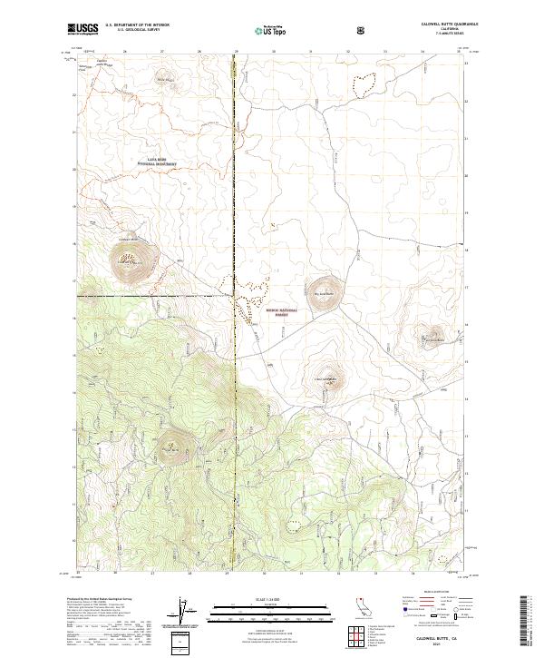
2021 Map of Caldwell Butte
USGS Topo · Published 2021About this map
Lava Beds National Monument and Modoc National Forest converge on this northern California terrain, where the volcanic history of the region is etched into the land. Significant geological formations like Schonchin Flow and a series of prominent cinder cones, including Caldwell Butte, Big Sand Butte, and Cougar Butte, dominate the landscape. The map reveals an intricate network of specialized paths such as Three Sisters Trl and Caldwell Minor Trl that wind through the high-elevation topography near the Siskiyou and Modoc county line. Cultural landmarks such as Captain Jacks Bridge provide specific points of interest within this protected wilderness. The road network is primarily composed of forest service routes, including the Medicine Lake Hwy and Main Park Rd, which facilitate access to these remote geological features.
Find a feature on this map
26 named features on this map. Tap any name to fly to it.
Don’t see what you’re looking for? This feature index may not catch every label — zoom into the map to look around manually.
Map Details
Editions of this 2021 Caldwell Butte Map
This is the sole edition of this map. No revisions or reprints were ever made.
Other maps of this area

1886 · Modoc Lava Bed
USGS Topo · 1:250,000

1892 · Modoc Lava-Bed
USGS Topo · 1:250,000

1950 · Mt. Dome
USGS Topo · 1:62,500

1951 · Tulelake
USGS Topo · 1:62,500

1952 · Timber Mountain
USGS Topo · 1:62,500

1952 · Medicine Lake
USGS Topo · 1:62,500

1954 · Alturas
USGS Topo · 1:250,000

1958 · Alturas
USGS Topo · 1:250,000

1962 · Alturas
USGS Topo · 1:250,000

1965 · Alturas
USGS Topo · 1:250,000