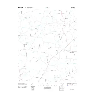
2013 Map of Caldwell
USGS Topo · Published 2013About this map
The North Fork Little River and South Fork Little River define the rural character of this northern Orange County landscape in the early 21st century. Small residential clusters and family enclaves like Berryland, Schley, and Laws sit among the headwaters of several drainages, connected by a network of winding roads such as Walnut Grove Church Rd and Hurdle Mills Rd. The presence of named developments like Springcrest Meadows and Charter Meadows suggests the gradual suburbanization of former agricultural land near the community of Caldwell. To the northwest, the Quail Roost Lake Number One and Quail Roost Lake Number Three reservoirs punctuate the drainage of Bushy Fork Cr, while smaller settlements like Larry Hall and Kindful Acres occupy the high ground between the river forks.
Find a feature on this map
135 named features on this map. Tap any name to fly to it.
Don’t see what you’re looking for? This feature index may not catch every label — zoom into the map to look around manually.
Map Details
Editions of this 2013 Caldwell Map
This is the sole edition of this map. No revisions or reprints were ever made.
Other maps of this area

1943 · Roxboro
USGS Topo · 1:62,500

1951 · Durham North
USGS Topo · 1:62,500

1953 · Greensboro
USGS Topo · 1:250,000

1954 · Greensboro
USGS Topo · 1:250,000

1962 · Greensboro
USGS Topo · 1:250,000

1966 · Greensboro
USGS Topo · 1:250,000

1967 · Cedar Grove
USGS Topo · 1:24,000

1968 · Efland
USGS Topo · 1:24,000
1968 · Hillsborough
USGS Topo · 1:24,000

1968 · Caldwell
USGS Topo · 1:24,000